
GEOSYSTEMS France GEOSYSTEMS France distributes solutions for processing aerial and satellite images, in France and in French-speaking countries in Africa. With many years of experience in providing hardwares, softwares & services in surveying and mapping, GEOSYSTEM France has developed a new data collection solution for georeferencing and surveying open trench utility networks - F3D.
F3D is a solution including hardware and software that allows to collect, process & digitize open trench utility networks.
.png)
Applications:
- Collect georeferenced images of the opent trench assets/ utility infrastructure before the backfill.
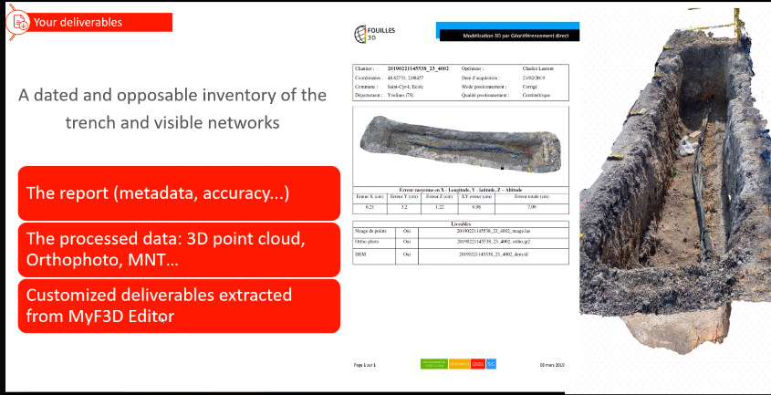
- Data processing and reporting on the web-based platform include: report (metadata, accuracy,...), 3D point cloud, Orthophoto, MNT,... . Extracting custumized deliverables (CAD files,...).
.jpg)
.png)

Features:
- A faster and easier method of georeferenced data collection, an easy-to-handle tool can be used by anyone and requires no expertise, nor expensive geodetic equipment;
- Delivers visual georeferenced data with centimeter-accuracy on every points of the assets;
- Data will be send in to platform to be automatically processed. In 10 minutes, the survey report is available by e-mail for real time quality control of the work done;
- Secure the site as soon as reports received and prevent the risk of accidents by not leaving any excavations open, minimize disturbance to residents and traffic in the area.
- Processed data (3D Point cloud) can be further customized on web-based platform integrated useful tools like: display projects on a map, draw the features on the orthophotos (lines, points, polygons), calculate the volume,... Customized deliverables can be extracted.
.jpg)
- Data can later be exploited on GIS platforms or virtual reality (VR) platforms:
.png)
.jpg)

