Ground-based radar interferometry is a powerful technique for monitoring terrain deformation
This is one of the most advanced Radar technologies today with applications for topographic surveying (Topography), remote monitoring of surface deformation with highest accuracy and large coverage area. All thanks to the simultaneous application of many different advanced Radar techniques:
- The basic principle of radar, sending a pulse of radio waves and measuring the ToF (time of flight) to determine the distance from the object to the radar.


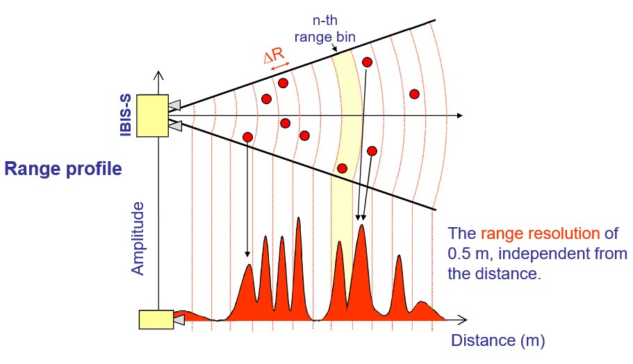
- The SFCW (Stepped Frequency Continuous Wave) radar detects the position in range of different targets placed along the radar’s line of sight
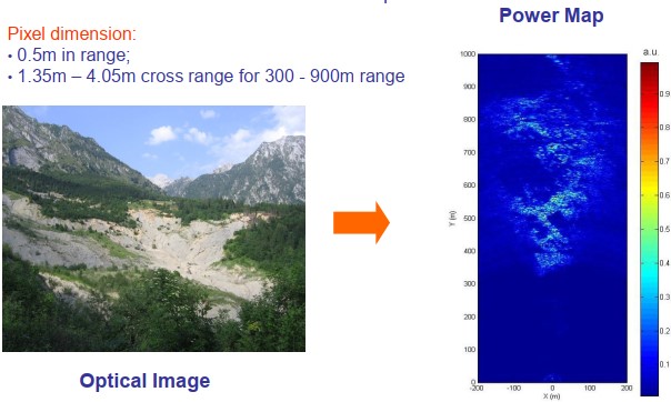
- The combination of SAR (Synthetic Aperture Radar) and SF-CW techniques allows the system to resolve the scenario into two dimensional pixels
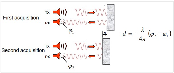
- The interferometric analysis provides data on object displacement by comparing phase information, collected in different time periods, of reflected waves from the object, providing a measure of the displacement with an accuracy of less than 0.01mm (intrinsic radar accuracy in the order of 0.001 mm.
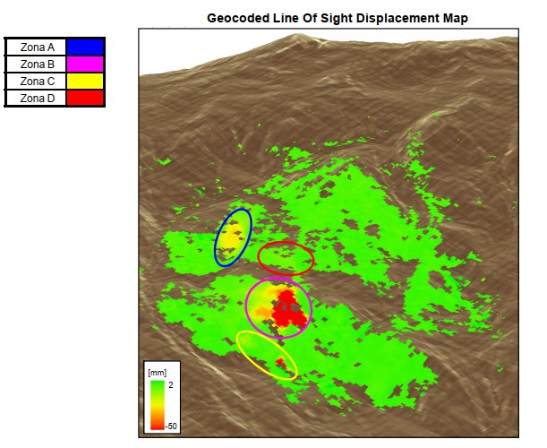
Nowaday, this technology is used in advanced monitoring systems to detect the displacement in the areas of interest, combined with specialized software allows real-time display of displacement results in model.
Typical Applications:
- Displacement monitoring of bridges, dams, buildings, heritage structures and other types of building in structure health monitoring (SHM). The results include real-time displacement, and even vibration frequency with specific equipment;
- Deformation monitoring & early warning of landslide for dangerous terrain;
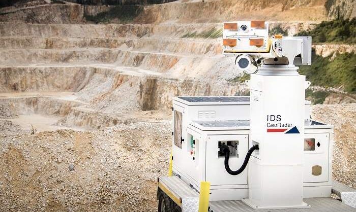
- Open pit mine monitoring and early-warning alerts in case of impending collapses;
- Blasting activities monitoring; Slope monitoring with the system able to locate, track and notify rockfalls, avalanches and debris flows in real time.
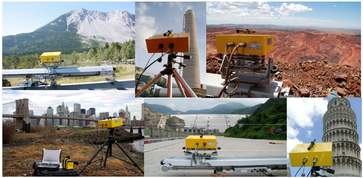
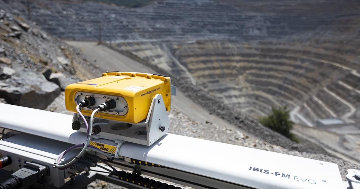
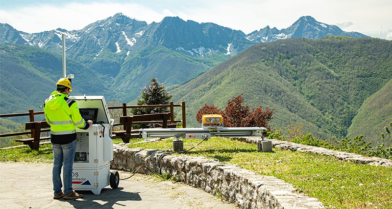

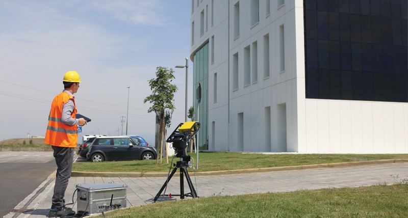
Advantages compared to “traditional monitoring method”:
- Real-time displacement (deformation) monitoring with sub-millimeter accuracy with the highest data quality;
- Large monitoring coverage area, up to several km2;
- Data can be transmitted wirelessly to Controlling center, data can be presented in 2D/3D model, feature for early warning set up,...;
- Remote monitoring, no need to access the monitoring area or install equipment and on hard-to-reach places;
- Scan time reduced to 30 seconds or even shorter with new techniques on advanced equipment, with ability to capture slow movement (mm/month) and fast movement (cm/h);
- Day-night continuous operation in all weather conditions with many power options: from grid, solar cells, diesel generators;
- Can be combined with sensors such as cameras, laser scanners to provide intuitive, easy-to-analyze data, or even integrate accelerometers to compensate for errors caused by ground vibrations.