 Brand: IDS GeoRadar (Italy) founded in 1980 as part of IDS Ingegneria dei Sistemi in Pisa, Italy, the company was recently acquired by Hexagon. This Company provides products and solutions for geophysical, mining, civil engineering and security applications. IDS GeoRadar is known as the World Leader in Multi-frequency, Multi-channel Ground Penetrating Radar (GPR) systems and also a pioneer of Interferometric technology applied to Civil Engineering and Earth Environment.
The first commercial ground-based interferometric radar with linear scan capabilities, the IBIS product line, was launched in 2007. This ground-breaking product range was unique to the field as it was the first use of interferometric technology for dynamic and static monitoring of structures and earth environments. The interferometric radar products provide a unique solution to the problem of monitoring small movements in ground or structures, allowing remote, long range, continuous real-time measurement of large areas. Dozens of companies and organizations in Vietnam have trusted the equipment of IDS GeoRadar for many different works.

Applications:
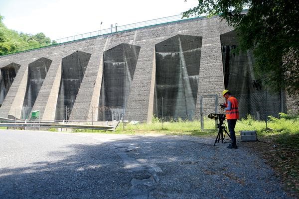
- HYDRA-G is a compact, remote sensing monitoring system designed for early warning and real-time measurements of sub-millimetric displacements in buildings, dams, tunnels, mining infrastructures, and cut-slopes;
- HYDRA-G is able to provide real-time monitoring of civil structures and cut-slopes deformations and trigger early-warning alerts in case of impending collapses to evacuate people and machinery at-risk.
With a scan range up to 800 metres, the system provides the high-accuracy and resolution radar technology. HYDRA-G exploits the cutting-edge ArcSAR technology, providing a spatial resolution of centimetres with updated displacement information every 30 seconds.
An optical and infrared HD camera provides real-time visual inspection of monitored areas, and radar data are draped on a 3D model of the scene created by the built-in laser. The industry-leading HYDRA Guardian software provides an easy-to-use and powerful tool to visualize and interpret radar data, and perform analysis of displacement trends of structure and cut-slope movements. Moreover, SurfScan is a dedicated, real time building displacement and deformation analysis software.
Benefits:
- Non-intrusive technology: no pointers or devices to be installed on the target;
- Hyper spatial resolution: to detect even the smallest displacement with sub-millimetric displacement accuracy;
- Fast acquisition rate: 30 seconds for a full resolution scan;
- Short range and large angular coverage capability: to track in real-time thousands of points in the monitored scenario;
- On-site results: data provided in real time with instant processing;
- 3D representation and visual imaging: to ease data interpretation of the monitored area;
- Compact and portable solution: easily transportable from a location to another and installed by one single person;
- High availability with low maintenance costs: minimal moving parts and low profile design to guarantee robustness and maximum availability in harsh environmental conditions.
HYDRA GUARDIAN SOFTWARE
Real time processing, data interpretation & early warning software
The industry-leading HYDRA Guardian software provides an easy-to-use and powerful tool to visualize and interpret radar data, and perform analysis of displacement trends of civil structure and cut-slope movements:
- Automatic atmospheric correction;
- Alarm generation with user defined levels;
- Multiple alarm criteria based on area definition;
- Email and SMS alarm forwarding;
- 3D interactive data handling;
- Output exportation to external software (CAD/GIS);
- External DTM importation.
SURFSCAN SOFTWARE
3D building monitoring software
SurfScan is a dedicated, real-time building displacement and deformation analysis software specifically developed for the building monitoring application of the solution:
- Single point of control for the complete monitoring system;
- Customizable scanned area selection;
- Point mapping over camera picture for easy data interpretation;
- Quick campaign set-up procedure;
- Flexible time series analysis panel for both real-time and post campaign analysis and reporting;
- Easy report generation.
The software is also suited for the monitoring of mining infrastructures.
https://www.youtube.com/watch?v=nO9N-ZTsdxA
