 Brand: IDS GeoRadar (Italy) founded in 1980 as part of IDS Ingegneria dei Sistemi in Pisa, Italy, the company was recently acquired by Hexagon. This Company provides products and solutions for geophysical, mining, civil engineering and security applications. IDS GeoRadar is known as the World Leader in Multi-frequency, Multi-channel Ground Penetrating Radar (GPR) systems and also a pioneer of Interferometric technology applied to Civil Engineering and Earth Environment.
The first commercial ground-based interferometric radar with linear scan capabilities, the IBIS product line, was launched in 2007. This ground-breaking product range was unique to the field as it was the first use of interferometric technology for dynamic and static monitoring of structures and earth environments. The interferometric radar products provide a unique solution to the problem of monitoring small movements in ground or structures, allowing remote, long range, continuous real-time measurement of large areas. Dozens of companies and organizations in Vietnam have trusted the equipment of IDS GeoRadar for many different works.
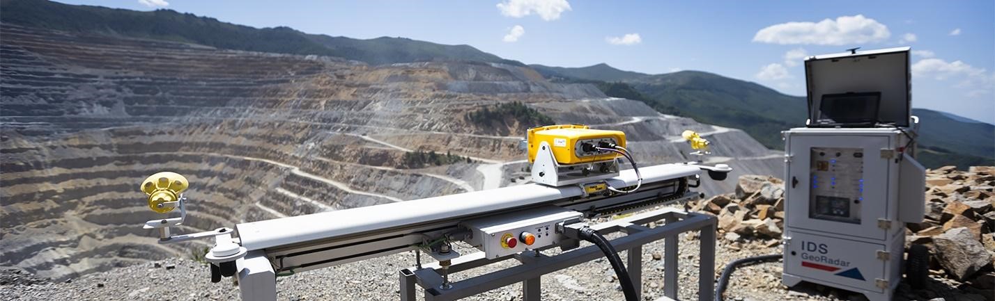
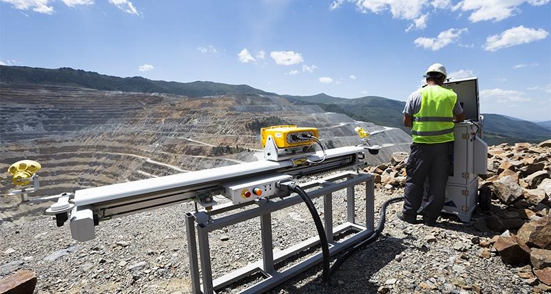
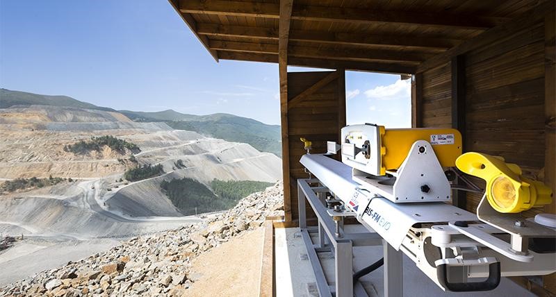
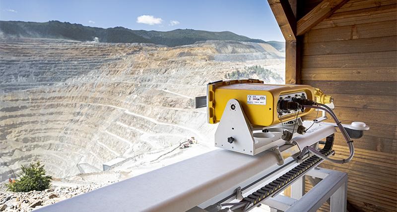
IBIS-FM EVO slope monitoring radar has been designed to measure sub-millimeter displacements with the highest data quality and proven system reliability. For broad ranges of monitoring of known and unknown slope instabilities, the IBIS-FM EVO offers the perfect solution for semi-permanent safety critical radar monitoring.
Same as the rest of the MineMonitoring radar fleet, IBIS-FM EVO uses the Guardian slope monitoring software for processing, interpretation, and management of slope stability risks. It can be seamlessly integrated in Guardian FPM360 in order to have a single user interface for all IDS radars and benefit from IDS GeoRadar state-of-the art atmospheric correction.
.jpg)
Features:
The reduced scan time of up to 30 seconds, now four times faster than before, and the new bidirectional scan, significantly reduce the impact of atmospheric variations and make it possible to track even faster slope movements than before.
IBIS-FM EVO has enhanced the already durable and trusted design of its predecessor, the IBIS-FM, to further improve operational availability and power consumption (reduced by up to 25%), confirming its position as the most dependable, durable semi-permanent radar on the market: a true set-and-forget.
Equipped with our most powerful radar sensor, combined with the unique free-running acquisition technique (patent pending), further improving the quality of the acquired data for better informed decisions.
With a maximum scan range of up to 5km, IBIS-FM EVO is designed to measure sub-millimeter displacements in real time with the highest data quality, able to measure multiple scales of displacements, from fast accelerations associated with the risk of collapse to early detection of very slow movements.
The design of the IBIS-FM EVO is optimized to minimize maintenance even in the harshest conditions. Remote trouble shooting is made easier with a dedicated, integrated live-streaming camera, which is particularly useful for installations where physical access to the system is difficult.
Durable design to further improve reliability and minimize maintenance and power consumption in the harshest conditions.
SOFTWARE
Guardian software
Powerful and user-friendly, the Guardian software manages slope stability risks in both geo-hazard assessment and open pit mining operations. Guardian enables fast interpretation and therefore fast reaction time to vital real-time information delivered by the IBIS-FM EVO radar system.
Reliable data with flexible alerts in real-time
Highly accurate displacement data is provided to monitoring specialists in real-time using the most advanced Automatic Atmospheric Correction algorithm.
Guardian offers alert messaging options and comprehensive geotechnical analysis tools. Monitoring specialists are immediately alerted in the event of slope displacement by means of various instant messaging options such as email, SMS or pop-up alerts.
Advanced data integration for even clearer understanding of slope stability
Automatically import different total station and GNSS datasets, for example from Leica GeoMoS©, to enable even clearer understanding of slope stability. Monitoring experts can com-pare prism and GNSS displacement trends, by mean of time series or Stereonet charts, with IBIS radar data to understand movement behavior that much faster.
Full Pit Monitoring 360 & True Vector
Guardian offers Full Pit Monitoring (FPM) capabilities, stitching together data sets from multiple IBIS radar systems onto a single radar map. The True Vector technology automatically resolve the spatial direction of displacement for hundreds of thousands of overlapping radar pixels monitored simultaneously by two or more radars.
Slope monitoring radar is a crucial tool for active monitoring of slopes in open pit mines and for safety-critical landslides, glaciers or dams monitoring. Alerts are provided in the event of progressive movements, which could potentially lead to slope failure. With early detection, accidents can be prevented. With long-term analysis, mine and civil engineering design can be optimized.

