After the use of geophysical survey equipment, FLASHRES UNIVERSAL 61 channel manufactured by ZzGeo, in Lap Thach district, Vinh Phuc province. Recently, the Faculty of Construction, Thuy Loi University conducted the second use of equipment at Khe Dang dam in Vinh Khuong commune, Son Dong district, Bac Giang province.
The mission conducted a survey of the longitudinal and cross section of the dam body (Figure 1), as follows:
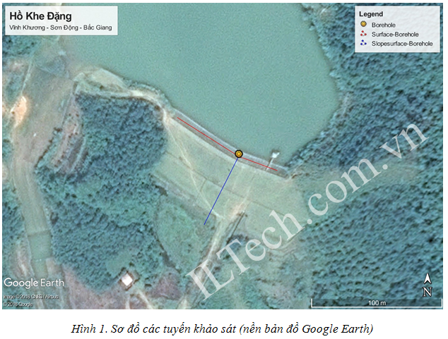
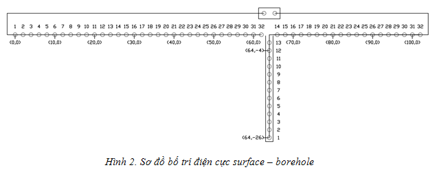
1. Surveying the longitudinal section of the dam's body: Using the borehole - surface survey diagram, using 64 electrodes, including 14 electrodes dropped into the borehole and 50 electrodes inserted on the dam face. The distance between the electrodes is 2m and the bore depth is 26m. The layout of the electrodes is sketched in the field as shown in Figure 2
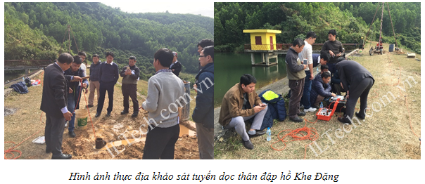
After a period of time the device automatically calibrates and calculates, the results obtained after being displayed through the sufer software are as follows:
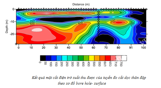

Based on the value of resistivity, it is possible to delineate areas of resistivity distribution, which can only be assessed as follows:
+ Zone (I): materials (may be sand, sand mixed with clay or clay) dry, cohesive;
+ Zone (III): water saturation;
+ Zone (II): state between (I) and (III).
The whole dam body is from 5 to 10 m deep to form a layer of water-containing material. In particular, the valve side of the material is saturated with water, which tends to be weak.
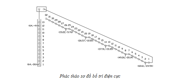
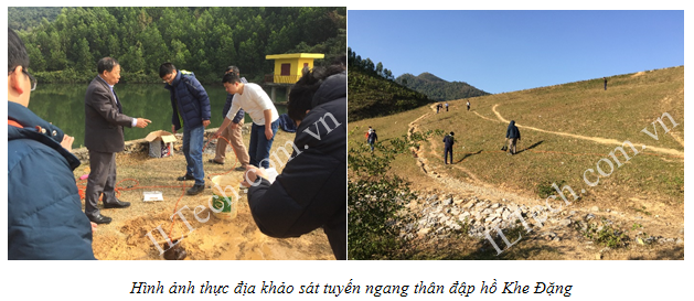
2. Cross-sectional survey of dam body: Using the borehole - slope surface survey diagram, using 32 electrodes, including 14 electrodes that are dropped into the borehole and 18 electrodes that are installed along the rib. slope of the dam. The distance between electrodes is 2m. The layout of the electrodes is sketched at the scene as shown below:
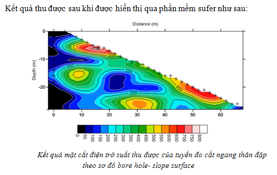
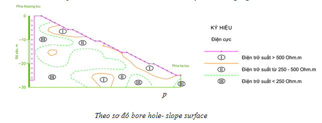
Based on the value of resistivity, it is possible to delineate areas of resistivity distribution which can only be evaluated as follows:
+ Zone (I): materials (may be sand, sand mixed with clay or clay) dry, cohesive;
+ Zone (III): water saturation;
+ Zone (II): state between (I) and (III).
Zone (III) - water saturation, which develops over the depth of the borehole, either due to near the upstream (reservoir side) or due to constant water supply during the measurement.
It is also possible to rely on (III) to assess the stability and permeability of dam materials (broken green lines) ...