• International Leading Technologies Transfer Company Limited
  • Tiếng Việt Tiếng việt
  • English English
  • Youtube
Logo
  • Home
  • About us
  • Products
    • NON DESTRUCTIVE TESTING PRODUCTS
      • CONCRETE TESTING PRODUCTS
      • STEEL TESTING PRODUCTS
      • INSPECTION PRODUCTS FOR TRANSPORT ENGINEERING
    • STRUCTURE MONITORING PRODUCTS
    • DIGITAL SOLUTION IN SMART CITY AND INFRASTRUCTURE
      • TECHNICAL INFRASTRUCTURE FLOATING ON THE GROUND
      • UNDERGROUND TECHNICAL INFRASTRUCTURE
    • ANALYSIS & SIMULATION SOFTWARE
    • GEOLOGICAL AND ENVIRONMENT SURVEY
    • ANALYSIS, MEASUREMENT AND MONITORING PRODUCTS
  • Services
  • News
    • Activity News
    • Specialized News
  • Documents
  • Contact us
  • iltech.com.vn
  • UNDERGROUND TECHNICAL INFRASTRUCTURE

Ground penetrating radar for utility location and mapping

IDS GeoRadar (Italy) a part of Hexagon AB (Switzerland) Group, is one of the leading equipment manufacturers in the world specializing in researching, developing, manufacturing and distributing Ground-Penetrating Radar (GPR/Georadar). IDS GeoRadar system can be applied to many different fields such as: detection and mapping of underground infrastructure, civil engineering, Geology and environment management, archeology...


Leica Geosystems (Switzerland), a part of Hexagon AB (Switzerland) Group, is the world's No. 1 brand of technology solutions for surveys, measuring, mapping, managing construction & manufacturing activities…


Currently, the Ground Penetrating Radar equipment (GPR/Georadar) of IDS GeoRadar and Leica Geosystems has been trusted by many agencies, organizations and businesses with more than 20 sets of equipment being used in Vietnam, Laos and Cambodia. 

Application:

- Underground utility mapping and detection (underground pipes/cable…);

- Detecting others underground objects, helping to detect the location of water leaks...
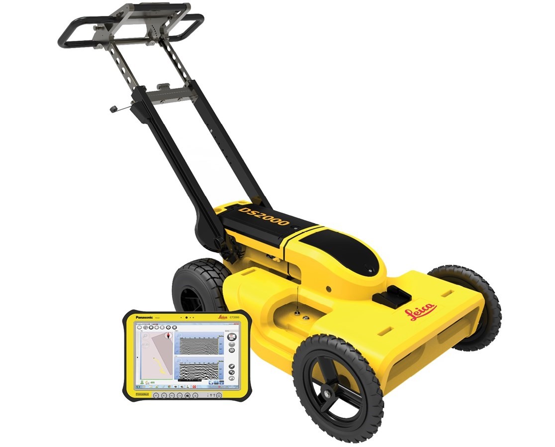
1. DS2000

The one and only advanced integrated solution for Utility Detection surveys.

Main features:

- With 4 wheel-cart configuration, sturdy, flexible design, easy to adjust the position of the handle, convenient for survey, folded when transporting;

- Dual-frequency Antennas 250 MHz & 700 MHz (shielded) will help to survey both objects at shallow depth and depth with only one single scan, simultaneously display the results of both center frequency on the same software interface;

- Intuitiveness – Just click the start button to receive the best performance in every soil condition. No need to perform calibration or adjust any other manual settings;

- Software for controlling, collecting and processing data uNext Basic allows using more than 20 languages, including Vietnamese, the software interface is intuitive and very convenient for users; GPS positioning device can be connected using NMEA communication standard;

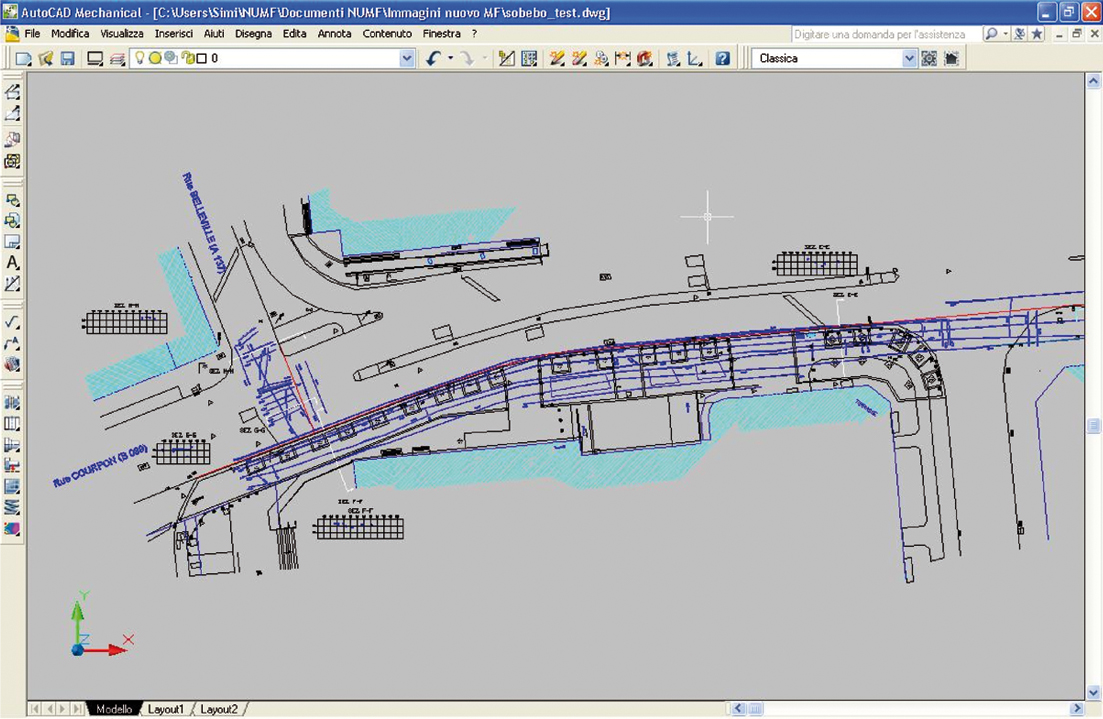
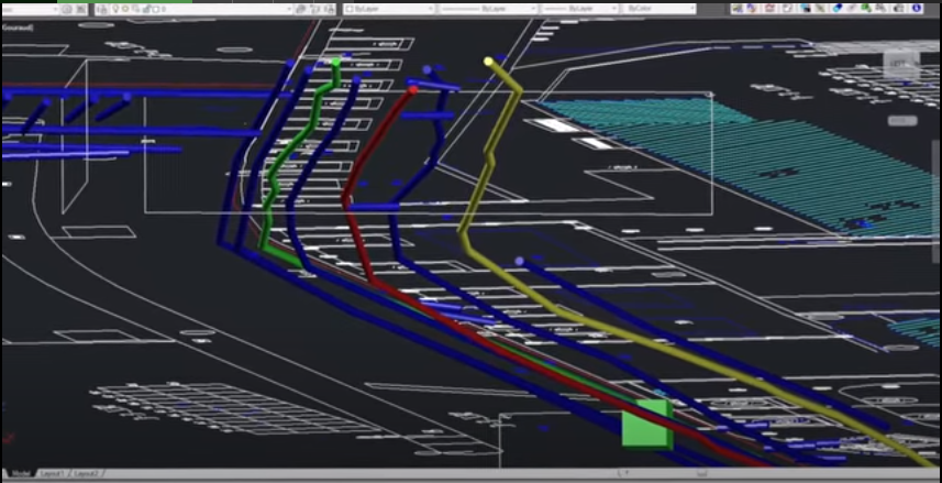
- Results Delivered On Site – The system tracks the position of the radar and marks targets automatically. All of the acquired data can be exported to CAD and GIS, and reports can be produced directly on site.


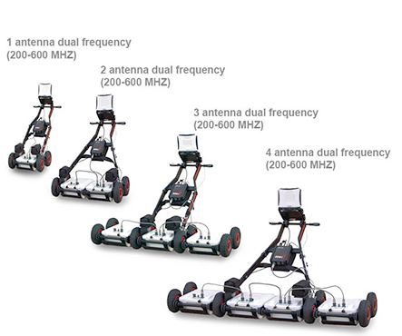
2. RIS MF HI MOD SYSTEM

The end-to-end solution for accurate underground utility mapping and GIS map creation.

General benefits of the RIS MF Hi-Mod GPR solution include:

- Deep and shallow antennas in one compact box: Two antennas in the same box, with the option of choosing 200 MHz & 600 MHz or 400 MHz & 900 MHz, help the operator to locate pipes and cables by providing the proper frequency for a specific search parameter. It provides a real-time display of deep and shallow antennas on the same screen;

- OneVision - Acquisition software for use in the field: roviding real-time target viewing, onsite object mapping and GPS navigation, OneVision is a software application for advanced GPR data collection This powerful tool can be used with an array of antennas when performing utility mapping, archeological and environmental surveys, and extensive mapping of medium to large size project;

- Modular: Antenna boxes can be quickly added in "chain connection" while in the field (no tools required) with up to 8” operation simultaneously. As a result, the system is able to work in any available space;

- 3D Radar Tomography: Multi-frequency data fusion and a consolidated procedure to collect the data enable accurate 3D images of the subsurface to be achieved, helping the operator to distinguish individual anomalies and buried targets;

- Professional utility mapping capability: The result can be exported in several formats including GIS and CAD (AutoCAD or MicroStation) for a professional survey.

Tags: máy dò công trình ngầm thiết bị dò tìm đường ống máy dò cáp ngầm máy dò đường ống ngầm máy dò ống nước ngầm máy dò tìm rò rỉ nước khảo sát công trình ngầm dò tìm công trình ngầm máy radar xuyên đất công nghệ radar xuyên đất máy nhìn xuyên lòng đất khảo sát công trình hạ tầng kỹ thuật đơn giá khảo sát công trình ngầm QCVN 57 2014 TCVN 9402 2012 TCVN 9426 2012 TCVN 8479 2010 ASTM D6432 underground utilities detection underground utility locator mapping underground utilities quy hoạch không gian ngầm quy hoạch hạ tầng kỹ thuật đô thị xây dựng công trình ngầm ngầm hóa hạ tầng bản đồ hiện trạng công trình ngầm giải pháp số hóa dữ liệu thiết bị đo đạc trắc địa IDS GeoRadar Leica Geosystems thiết bị đo địa vật lý Ground Penetrating Radar water leak detector

Products

  • NON DESTRUCTIVE TESTING PRODUCTS
    • CONCRETE TESTING PRODUCTS
    • STEEL TESTING PRODUCTS
    • INSPECTION PRODUCTS FOR TRANSPORT ENGINEERING
  • STRUCTURE MONITORING PRODUCTS
  • DIGITAL SOLUTION IN SMART CITY AND INFRASTRUCTURE
    • TECHNICAL INFRASTRUCTURE FLOATING ON THE GROUND
    • UNDERGROUND TECHNICAL INFRASTRUCTURE
  • ANALYSIS & SIMULATION SOFTWARE
  • GEOLOGICAL AND ENVIRONMENT SURVEY
  • ANALYSIS, MEASUREMENT AND MONITORING PRODUCTS

New article news

ILTech Successfully Transfers Software Application in Oceanography ILTech Successfully Transfers Software Application in Oceanography
14/05/2025
ILTech_Completely transferring seismic equipment from Guralp (UK) ILTech_Completely transferring seismic equipment from Guralp (UK)
11/12/2024
ILTech completed the supply of seismic exploration equipment model X820S (24 channels) of M.A.E (Italia) ILTech completed the supply of seismic exploration equipment model X820S (24 channels) of M.A.E (Italia)
24/02/2024
Letter Of New Year Wishes For The Dragon 2024 Letter Of New Year Wishes For The Dragon 2024
03/02/2024
ILTech signed a contract to provide 11 sets of modern, high-tech equipment for geological - hydrological surveys and construction quality inspection ILTech signed a contract to provide 11 sets of modern, high-tech equipment for geological - hydrological surveys and construction quality inspection
03/02/2024

Documents

  • 02/07/2021: TCVN 12584:2019_Safety traffic equipment - Retroreflecting road studs - Techincal requirements and test methods
  • 02/07/2021: TCVN 12584:2019_Safety traffic equipment - Retroreflecting road studs - Techincal requirements and test methods
  • 02/07/2021: TCVN 8867:2011_Flexible pavement - standard test method for determination of elastic modulus of pavement structure using Benkelman beam
  • 02/07/2021: TCVN 8860-1: 2011_Asphalt Concrete – Test methods – Part 1: Determination of Marshall Stability and Pl astic Flow
  • 02/07/2021: TCVN 12585:2019_Safety traffic equipment- Delineator posts and retroreflectors - Technical requirements and test methods
  • 02/07/2021: TCVN 8819:2011_Specification for Construction of Hot Mix Asphalt Concrete Pavement and Acceptance
  • 02/07/2021: TCVN 11365:2016_Pavement Airport: Standard Test Method for Evaluation Pavement Classification Number (PCN) Using a Heavy-Falling Weight Deflectometer (HWD)
  • 02/07/2021: TCVN 10832:2015_Retroreflective pavement marking materials - Color - Specifications and test methods
View more

Gallery

  • Holiday!!!
  • Delivery and Training GALLERY
  • Exhibition, Seminar, Workshop...

Video

  • Underground Utilities Mapping for Smart Cities in Vietnam

    Underground Utilities Mapping for Smart Cities in Vietnam

  • Siêu âm cọc khoan nhồi tại tỉnh Quảng Ninh/ Cross-hole Sonic Logging model All-in One (Italia)

    Siêu âm cọc khoan nhồi tại tỉnh Quảng Ninh/ Cross-hole Sonic Logging model All-in One (Italia)

  • Discover Instantel's Micromate Monitoring Unit

    Discover Instantel's Micromate Monitoring Unit

  • Proteus Pipeline Crawler Inspection System

    Proteus Pipeline Crawler Inspection System

  • PCSS - Pavement Condition Survey System

    PCSS - Pavement Condition Survey System

About us

International Leading Technologies Transfer Company Limited

Hanoi Office: 3A Floor, Lidaco – Vinaconex 7 Building, 19 Dai Tu Road, Hoang Mai Dist, Hanoi, Vietnam

HCMC Office: 58/48 Nguyen Minh Hoang, Ward 12, Tan Binh District, HCMC

Tel: (84-24) 6027 8662

Email: info@iltech.com.vn/ inter-cooperation@iltech.com.vn

Hotline: (84) 914 382 786

© Company Theme. All Rights Reserved. Designed by ILTech