Today, with dense urban development, it is imperative to take advantage of the extra underground space to share the above pressure, especially in large cities. In order to do that, an underground space construction plan should be prepared as a basis for future underground works to develop. A suitable spatial planning map will now be the focal point to solve the utility infrastructure problems that urban areas are currently facing.
It is very urgent to create underground maps for large cities like Hanoi. Projects on surveying, measuring and setting up the current situation map of the entire network of underground utility infrastructure works in the city will serve as a basis for making a planning map and developing underground space. , as a premise for the planning, management and construction of underground works in the future. In order to do that, it is necessary to have an effective support tool for solutions to detect & map the underground utilities
Ground-penetrating Radar (GPR / Georadar) technology is commonly used in the world and increasingly applied in Vietnam for many specialized technical fields, including work detection and underground utilities maping.
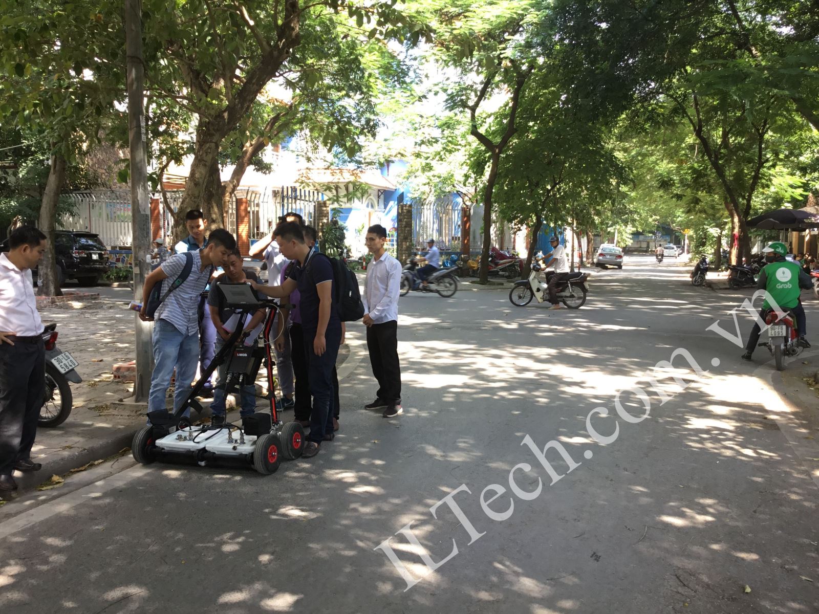
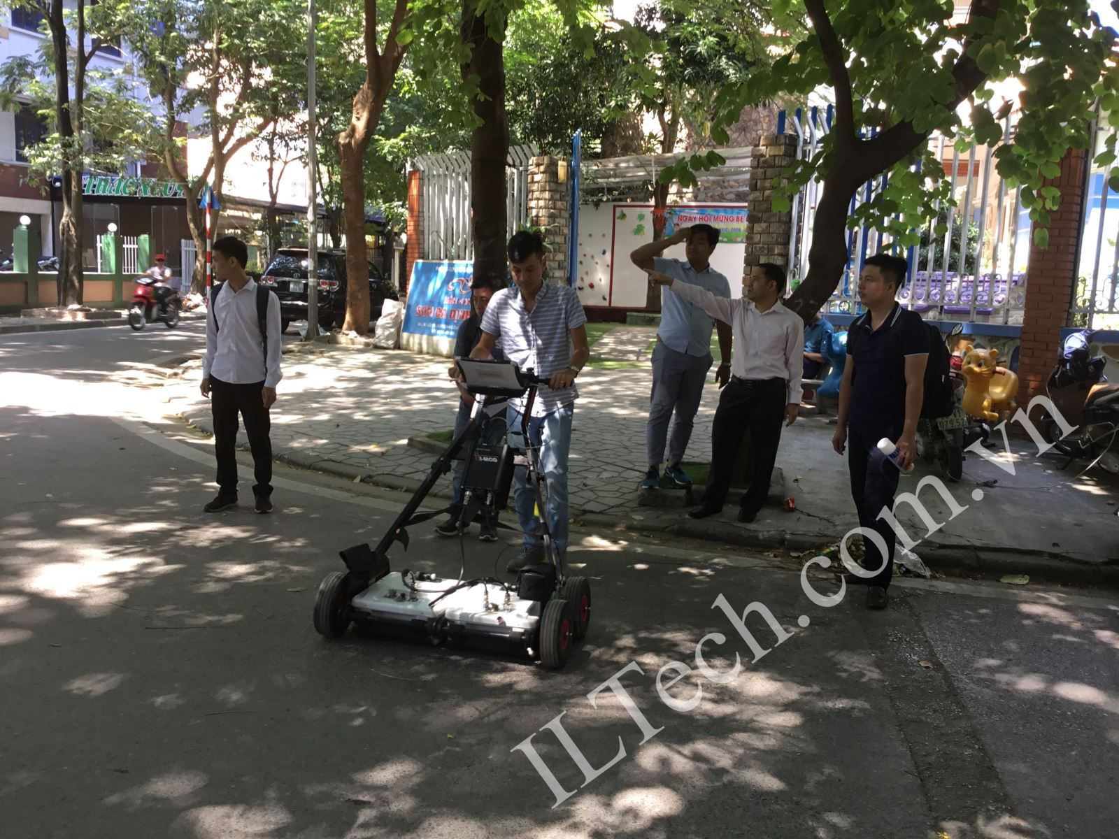
On 04 - 05/10/2018, International Leading Technologies Transfer Co., Ltd. (ILTech) cooperated with a number of domestic and foreign partners to test RIS MF Hi-Mod # 2 device to map the underground utilities in some streets in Hoang Mai District, Hanoi City.


Using ground penetrating radar device of IDS GeoRadar (Italy) for field survey
https://www.youtube.com/watch?v=juIOXtSCVdg&t=3s
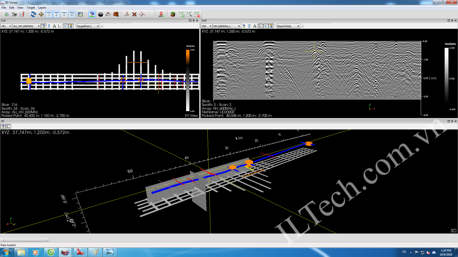
Some results of underground utilities maping works on a street:

Processing on software for 2D / 3D mapping of underground technical infrastructure works

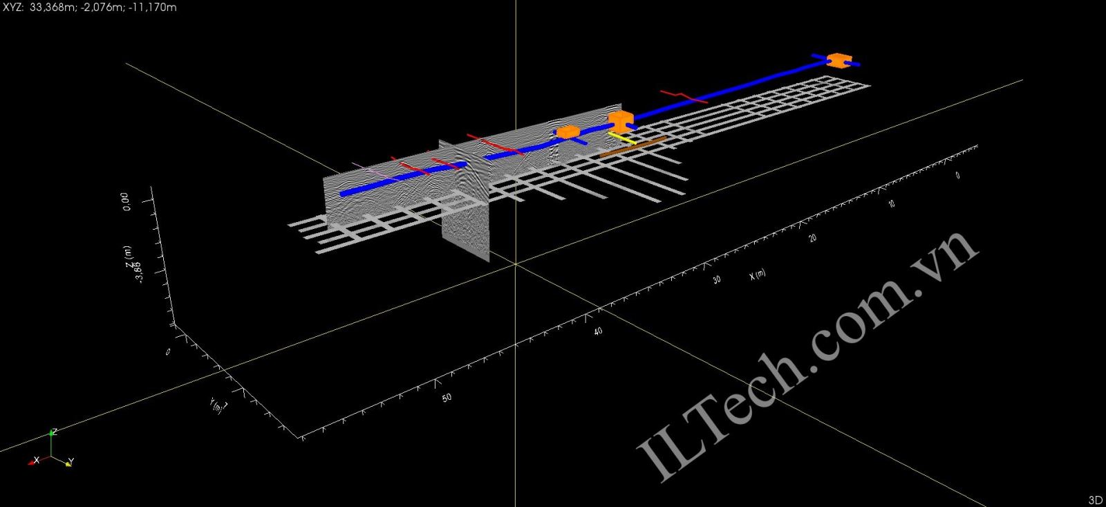
3D map of underground utility infrastructure
The results can be automatically exported to CAD and GIS formats.