With a population of more than 13 million people living and working in, Ho Chi Minh City is facing huge difficulties in transportation infrastructure, environmental pollution, especially in the context of land fund in the downtown area. The city has exhausted, causing traffic congestion in the central area, the gateway areas into the city. Therefore, the planning and development of underground space to open more space for transport, services and commerce underground is one of the topics that are of particular interest to the city today. .
In recent years, many projects, guidelines, and scientific seminars have been organized to discuss the planning and development of underground space in urban areas in Ho Chi Minh City. One of the current problems is the management of synchronous data on existing underground technical infrastructure works (water supply / drainage pipes, electric cables, telecommunication cables ...). The lack of this synchronous data causes difficulties in the process of construction contractors, especially when constructing metro lines with a huge volume and scope of works.
Understanding this, ILTech Company recently held a test of Ground-penetrating Radar equipment (GPR) of IDS Georadar (Italy) in Ho Chi Minh City. The purpose of this trial is to evaluate the ability of GPR methods and equipment to examine existing underground technical infrastructure facilities.
1. GPR equipment used for testing session:
- Model: Detector Duo.
- Manufacturer: IDS Georadar, Italy.
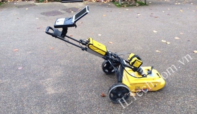
Figure 1. GPR equipment used for the test, Detector Duo model, IDS Georadar, Italy
2. Testing content:
The trial was held at the intersection of Nam Ky Khoi Nghia, Alexandre de Rhodes and Pasteur, District 1, HCMC. In this area, the testing team made 3 measurement points as follows:
- Measurement point 1: In front of the Department of Natural Resources & Environment, Alexandre de Rhodes Street.
- Measurement point 2: Crossing the intersection of Pasteur and Alexandre de Rhodes roads.
- Measurement point 3: On the sidewalk of the intersection of Pasteur and Alexandre de Rhodes roads.
The test results are as follows:
- At point 1: Select the T2 measuring line (from the direction of Park April 30 to the wall of DONRE). As a result of the T2 measurement line, there are a number of suspicious locations with underground technical infrastructure works at depths from 0.2 to 1.1 m, including water pipes and electric cables (see also figure 2). In addition, based on the received GPR signal, it is possible to identify locations with the reinforcement mesh below.
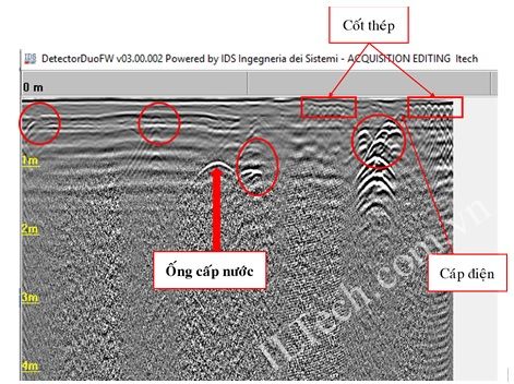
Figure 2. Results obtained at the T2 measuring line.
- At point 2: Select the measuring line T4 (crossing the Pasteur road). The result is that at some locations with the depth from 0.2 to 0.9 m, some suspicious locations are detected as water supply and drainage pipes (see Figure 3).
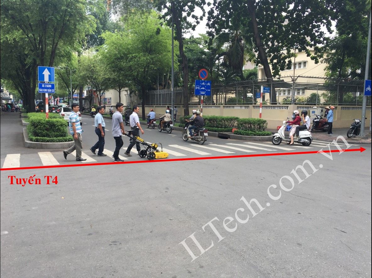
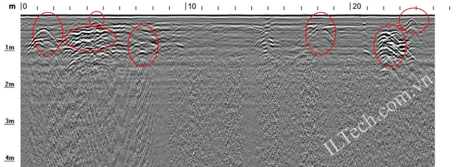
Figure 3. Location of T4 measurement line and results obtained.
- At point 3: Select the measurement lines T5 and T6 (on the sidewalk of the intersection of Pasteur and Alexandre de Rhodes). Through field observations, the two measurement routes go through 02 large sewer covers. As a result, in addition to 2 drainage covers, it was discovered that the drainage pipes extended at a depth of 0.3 to 0.9 m.
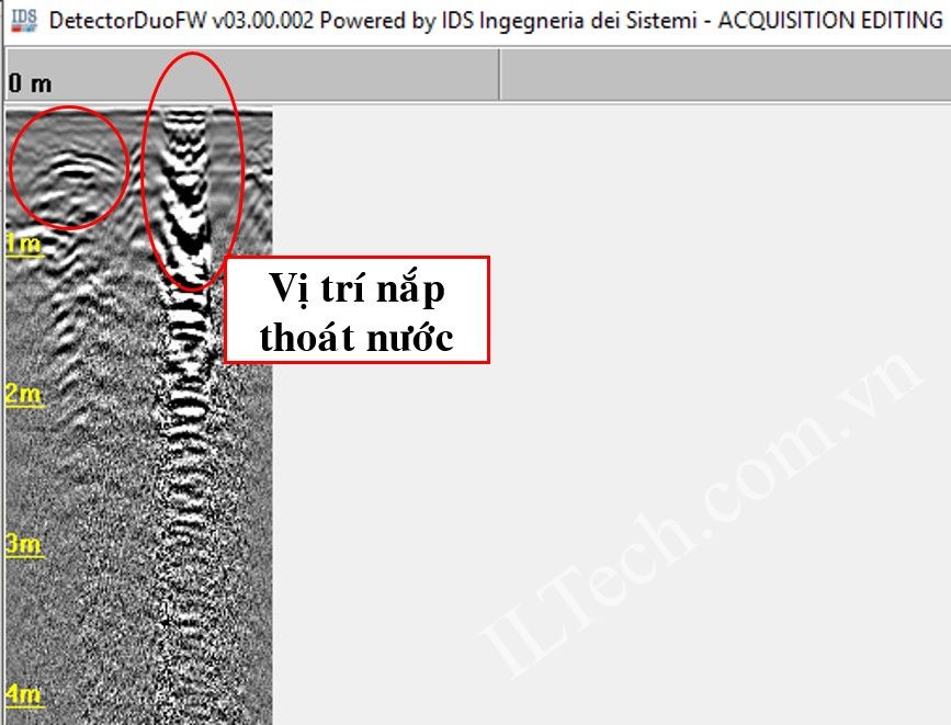
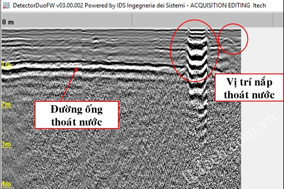
Figure 4. The results obtained at the location of lines T5, T6
3. Conclusion
- Due to the traffic and terrain conditions, it is not allowed to draw the survey grid, so the test can only conduct the scanning surfaces in the appropriate directions.
- GPR equipment, model Detector Duo has detected underground constructions such as water supply and drainage pipes, power cables, signal cables which made of metal or nonmetal materials.
- The objects which are detected with typical signals showing the shape of pipelines and electric cables need to have more intensive interpretation steps combined with the existing information / drawings to distinguish these objects as supply pipelines. water, drainage pipes or electric cables ...
- GPR equipment, Detector Duo model of IDS Georadar used for the testing session is the old model that has stopped production. Currently, Opera Duo model is a new model to replace the old Detector Duo model. In addition to inheriting the 250 and 700 MHz dual frequency antennas of the previous model, which allows detection and display on the same screen and results in both deep and shallow objects, Opera Duo also has other advantages as follows:
+ Hardware design makes the device more durable, easy to transport and user friendly. The device can easily adjust the handle position for user convenience, folds when transporting, swivel neck mechanism helps stabilize the antenna, using up to 2 distance-measuring counters to determine the position, and Automatic paint spray helps mark objects in the field (controlled by software) ...
+ Allows to choose from more than 20 different languages, including Vietnamese;
+ Automatically calibrate the device with a single button to get the best operating mode on each geological condition;
+ Connect to GPS locator using NMEA communication standard;
+ Can use 3D data processing software of IDS GeoRadar Firm to analyze in depth the data collected from Opera Duo device ...
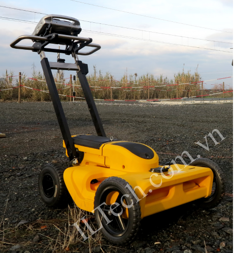
For more information:
https://www.youtube.com/watch?v=hvReNttQNe0&t=17s